
Knox County ZIP Code Coverage
The May 2023 KGIS Area Zip Codes map lists 28 ZIP codes in its local area. The table preserves the map's community context and its cautions. KGIS coverage is useful for geographic orientation, while USPS verifies delivery labels for a particular address. The Knox County ZIP code directory should therefore be read as a map-and-address aid rather than a city-limit chart.
| ZIP | Areas Covered | Post Office | Notes |
|---|---|---|---|
| 37709 | Northern/eastern county-edge area | Verify USPS by address | KGIS area list, not a city boundary |
| 37754 | Northern county-edge area | Verify USPS by address | Confirm a delivery point |
| 37764 | Maynardville and Union County edge context | Verify USPS by address | May include addresses outside Knox County |
| 37772 | Powell and northern context | Verify USPS by address | City and county boundaries differ |
| 37779 | Northern/eastern county-edge context | Verify USPS by address | Confirm a delivery point |
| 37806 | Blaine and outer-east context | Verify USPS by address | Area map, not a resident roll |
| 37807 | Outer Knoxville-area context | Verify USPS by address | Confirm a delivery point |
| 37830 | Oak Ridge regional-edge context | Verify USPS by address | May include addresses outside Knox County |
| 37849 | Kodak and eastern regional context | Verify USPS by address | Confirm a delivery point |
| 37853 | New Market regional-edge context | Verify USPS by address | May include addresses outside Knox County |
| 37871 | Rutledge regional-edge context | Verify USPS by address | Confirm a delivery point |
| 37902 | Downtown Knoxville | Knoxville USPS service area | Mailing geography, not one jurisdiction |
| 37909 | West and central Knoxville context | Knoxville USPS service area | Verify exact delivery point |
| 37912 | Central and northwest Knoxville context | Knoxville USPS service area | Check city limit and parcel |
| 37914 | East Knoxville context | Knoxville USPS service area | KGIS community context |
| 37915 | Downtown and east-central context | Knoxville USPS service area | Not a neighborhood boundary |
| 37916 | UT and central Knoxville context | Knoxville USPS service area | Verify a specific address |
| 37917 | North and east-central context | Knoxville USPS service area | Verify a specific address |
| 37918 | Fountain City and north Knoxville context | Knoxville USPS service area | Community names are not ZIP borders |
| 37919 | Bearden and west Knoxville context | Knoxville USPS service area | Check city and ZIP boundary |
| 37920 | South Knoxville and river corridor | Knoxville USPS service area | Verify a specific address |
| 37921 | West and southwest Knoxville context | Knoxville USPS service area | Edge use needs address verification |
| 37922 | West Knoxville and West Hills context | Knoxville USPS service area | Verify a specific address |
| 37923 | Cedar Bluff and Bearden-west context | Knoxville USPS service area | Verify a specific address |
| 37924 | East and southeast Knoxville context | Knoxville USPS service area | KGIS uses it as a ZIP-layer example |
| 37931 | Karns and Hardin Valley context | Knoxville USPS service area | Verify a specific address |
| 37932 | Hardin Valley and Concord-west context | Knoxville USPS service area | Verify a specific address |
| 37934 | Concord and outer-west context | Knoxville USPS service area | Verify a specific address |
| 37938 | Outer north and east context | Knoxville USPS service area | Verify a specific address |
ZIP 37721 appears in some general local lists but was not in the inspected KGIS map list. That is an address-verification issue, not a reason to silently add it to the mapped area. The research did not confirm every station, PO-box-only ZIP, or unique ZIP for Knox County, so a USPS result remains the final postal check.
Knox County ZIP Code Clusters
Central ZIPs hold several different local reference points. KGIS places downtown in 37902, gives 37909 a west and central context, and places 37912 in central and northwest Knoxville. East-side context includes 37914, 37915, 37917, and 37924. North-side searches may encounter Fountain City in 37918, Powell context in 37772, and outer north or east context in 37938. Those are useful search variants when a source uses a community name instead of “Knoxville.”
West and south clusters are equally mixed. The KGIS map connects Bearden with 37919, West Hills with 37922, Cedar Bluff with 37923, Karns and Hardin Valley with 37931, and Hardin Valley or Concord-west with 37932. It also gives 37920 a South Knoxville and river-corridor context. A community label can help find a map feature, but it never replaces the full address, parcel, or municipality in a Knox County record.
Knox County ZIP Code Search Fields
GoVoteTN is the verified ZIP-capable public portal in the research. It accepts a first and last name with ZIP, or an address and ZIP, for registration and polling information. It does not produce a ZIP-wide resident list. The state voter lookup uses a different path: county, first name, last name, birth month, and birth year are all required. Use its output narrowly as a match check and direct full-file questions to the Knox Election Commission.
The official GoVoteTN lookup presents the name-and-ZIP and address-and-ZIP paths for election information.
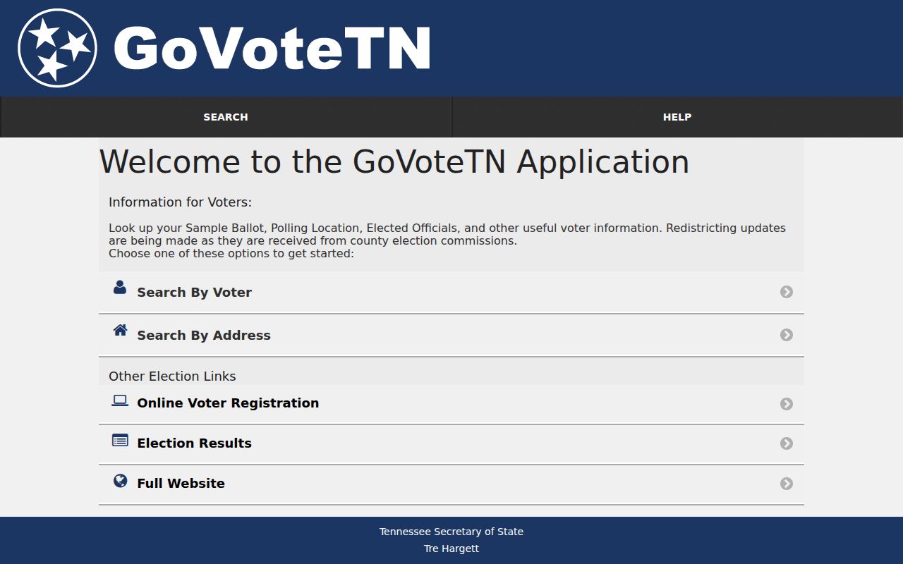
The form illustrates a specific inquiry, not a ZIP-wide roster. It can help verify polling details once the correct name or address is already known.
| Portal Field | Input | What the Field Supports |
|---|---|---|
| GoVoteTN first and last name | Text, paired with ZIP | Specified registration and polling query |
| GoVoteTN street address | Address controls plus ZIP | Polling, sample-ballot, and elected-official information |
| State lookup county | Required select | Limits a name query to Knox County |
| State lookup name and birth month/year | Required text and selects | Identity check, not a full date-of-birth display |
| KGIS mobile ZIP field | Map-layer field | Mapped local context alongside address and parcel data |
The Knox assessor's advanced route has a property-address field, but the research did not verify a dedicated ZIP-wide owner filter. The permit search is built around street, parcel, date, status, and work type. The Register of Deeds uses parties, instruments, and legal descriptions rather than a neighborhood ZIP field.
Find Knox County Residents by ZIP
A ZIP can narrow the geography around a known person or address, but it should not be treated as a household inventory. Use the postal, map, and election tools in that order, then move to the parcel or record source that has the actual search field you need.
- Use the USPS ZIP Code Lookup with a complete delivery address to confirm the postal ZIP. USPS cautions that a ZIP result does not confirm that a person or company is at that address.
- Open KGIS and turn on the ZIP Code layer with parcel, street, or neighborhood layers to see the Knox County map context around the address.
- For polling information, use GoVoteTN with the specified name and ZIP or the address and ZIP. A no-match can reflect spelling, a recent address change, or a maintenance issue.
- Use the Property Assessor, Register of Deeds, clerk, or Election Commission for the specific record question. Ask the custodian about records requests, field availability, and restrictions.
Once a ZIP is narrowed to a known street, the Knox County by-street directory has the address, parcel, deed, permit, and map sequence. A ZIP alone cannot show every current resident or household member.
Knox County ZIP Code Limits
Myth: a ZIP boundary is the same as a city line, parcel line, school zone, or voting precinct. In Knox County, KGIS serves the county, the City of Knoxville, and KUB, while the city neighborhood directory applies only inside city limits. A mailing address may say Knoxville even when a parcel is outside the City of Knoxville or in another municipal jurisdiction.
That distinction affects where a record belongs. Check the appropriate KGIS city or county boundary layer before treating a mailing label as municipal status. The ZIP map also names communities such as Bearden, Fountain City, Halls, Karns, Hardin Valley, Concord, Carter, Holston Hills, Sequoyah Hills, Powell, Mascot, and Gibbs. Each can be a helpful source term, but none is proof that an address shares the same boundary.
Knox County ZIP Boundaries
USPS delivery geography, a mailing city, a situs municipality, and a KGIS mapped Area Zip Code are separate labels. ZIP boundaries do not necessarily follow county, city, parcel, precinct, or school-zone lines. A portal that accepts a ZIP often searches only the address field it stores, so an apparent ZIP result can miss records that use a different mailing or situs address.
The official addressing chain is KGIS and the Metropolitan Planning Commission. KGIS says its geocoder uses address points, not address ranges, and refreshes from a weekday snapshot around 5:00 p.m. If an address does not geocode, remove city, state, and ZIP, try the street's core name, use Address Builder, and then compare parcel and legal-description data. For an official address question, KGIS lists 606 Main Street, Suite 150, 865-215-2641, and kgis@kgis.org; call before visiting.
Using Knox County KGIS Carefully
KGIS can bridge a ZIP question to a stable parcel question. Search by Address, Parcel, Owner, Place, or Other, then identify the parcel on the map. The report can expose owner, address, and parcel ID, with layers for parcels, buildings, streets, subdivisions, voting districts, school zones, city neighborhoods, ZIP codes, and historical aerials. The map is a research reference, not an exact survey.
A parcel ID can survive a street-name or numbering change better than a ZIP. Knox County's pattern starts with a three-digit control map, followed by a two-letter group or blank, then parcel and special-interest components. Preserve the full string, including its suffix. A plat or legal description can supply the next bridge when a postal label or street number fails.
Knox County ZIP Code Definitions
Postal terms need careful use in a Knox County ZIP code search. The research did not exhaustively confirm which local codes are PO-box-only or unique to an institution, so the definitions below describe how USPS labels work rather than assigning a special status to any particular Knox code.
- ZIP Code and ZIP+4
- A five-digit ZIP sorts mail to a broad delivery area. ZIP+4 adds four digits that narrow delivery to a smaller segment or address range.
- PO-box ZIP
- A ZIP assigned for post-office box delivery. Its use and current label should be confirmed with USPS for the mailing address involved.
- Unique ZIP
- A ZIP used for one large organization or delivery arrangement. Do not assume one exists locally without a current USPS result.
- Carrier route
- A postal delivery grouping used to organize mail service. It is not a municipal boundary or a resident directory.
Use the ZIP as one field among several. The full address, parcel, legal description, mailing city, and record date provide the context a postal code cannot.